► Japanese
KAGUYA high-precision Spectral Profiler (SP) data are released
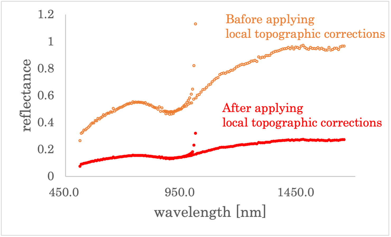
We release the high-precision Spectral Profiler (SP) data obtained by applying the local topographic corrections to the original spectral data acquired by the continuous visible-near infrared Spectral Profiler onboard KAGUYA. In this preliminary release, original SP data corresponding to a part of the south polar region were used for the higher-level processing.
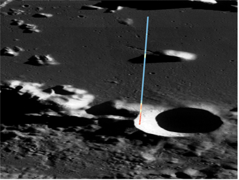
The upper image, taken by LRO/WAC, shows the area around the center of the Antoniadi Crater located in the south-polar region of the Moon (69.5S, 187.5W). Typical size of the small craters seen near the bottom of the image is about 10 km in diameter. The colored zone represents the SP footprint, where the color variations indicate slope differences. The local topographic corrections are made not only for the slope steepness but also for the slope azimuth (not represented here). The bottom figure is an example of the local topographic corrections for SP_2C_03_02848_S696_E1870.spc (Line#83 at 70.388S, 186.945E). The observation point corresponds to the lower-end of the colored zone in the upper image.
(Nov 2023)